
Penn Township ZIP Code Coverage
Penn Township, Westmoreland County, has more postal geography than its municipal name suggests. The Township history says that nine ZIP zones serve it, but the researched official material does not publish a complete authoritative list of those nine zones. The documented anchors below are therefore useful starting points, not a claimed full boundary chart. Check the address with USPS and then turn on the Township boundary in County GIS before choosing a custodian or describing a place as inside Penn Township.
The table identifies only labels supported by official Township or local public-resource addresses. Each can occur in Township research, yet none draws the Township line. The post-office column names the documented postal locality rather than asserting a delivery-office boundary or a service area.
| ZIP | Documented Penn Township anchor | Postal locality | Record-search note |
|---|---|---|---|
| 15636 | Township public-service address | Harrison City | Public-service anchor, not a Township-wide boundary. |
| 15642 | Public-safety and fire-service address | Irwin | Postal label does not establish municipal identity. |
| 15085 | Local fire-service address | Trafford | Cross-postal clue near the Allegheny County line. |
| 15644 | Local fire-service address | Jeannette | A neighboring-city mailing label needs a GIS check. |
| 15623 | Local fire-service address | Claridge | Locality anchor only, not complete postal coverage. |
Four additional zones are mentioned in Township history without names. It would be misleading to fill that gap from an unverified third-party list. USPS validation and the County map are the reliable route for a specific address.
Penn Township ZIP Postal Anchors
Harrison City, Level Green, Claridge, Paintertown, and Grandview are useful locality clues in Penn Township records. They are not interchangeable government boundaries. The municipal building and library use Harrison City, while the Police Department uses Irwin. Level Green uses a Trafford address, and Grandview uses Jeannette. Those examples from the Penn Township history explain why a record search should retain the displayed postal city but test the parcel against the municipal layer.
The Township’s ward map adds a second, separate geography. Five wards and eleven precincts organize local civic administration. Roads such as Route 130, Route 993, Harrison City-Export Road, and Claridge-Export Road can lead toward another municipality. A road name, ZIP, or precinct is context, not proof that a given parcel lies in the Township.
Verify a Penn Township ZIP
Use the USPS address and ZIP lookup for the delivery form, then use Westmoreland GIS Tax Mapping for the municipal and parcel context. USPS answers a mail-routing question. The map can place a parcel and display the Penn Township boundary. When a property record matters, the County assessment entry and the Recorder’s instrument are separate checks.
A displayed mailing city should be preserved as a source detail, especially in historical material. It should not be converted into a municipal conclusion. For parcels near a border, save the parcel identifier, displayed situs address, municipal result, and map date together. That creates a dated record trail instead of relying on a postal shorthand.
- Enter the complete street address in the USPS tool and retain the returned delivery format.
- Find the same location in County GIS and inspect the Penn Township municipal-boundary layer.
- For a property question, compare the parcel with the Westmoreland Real Property Search.
- For a recorded land question, inspect the related instrument through the Recorder Public Access index and the underlying document.
That sequence separates delivery data, geography, tax information, and recorded title evidence. A ZIP alone cannot supply any of the later answers.
ZIP Code Searches in Penn Township
No reviewed County property portal was documented with a public ZIP filter. The Real Property Search is built around parcel number, owner name, and location. Its location instructions call for the street core without directional prefixes, suffixes, or the street designator. That makes it useful once an address is known, but it is not a way to produce a ZIP-wide people list.
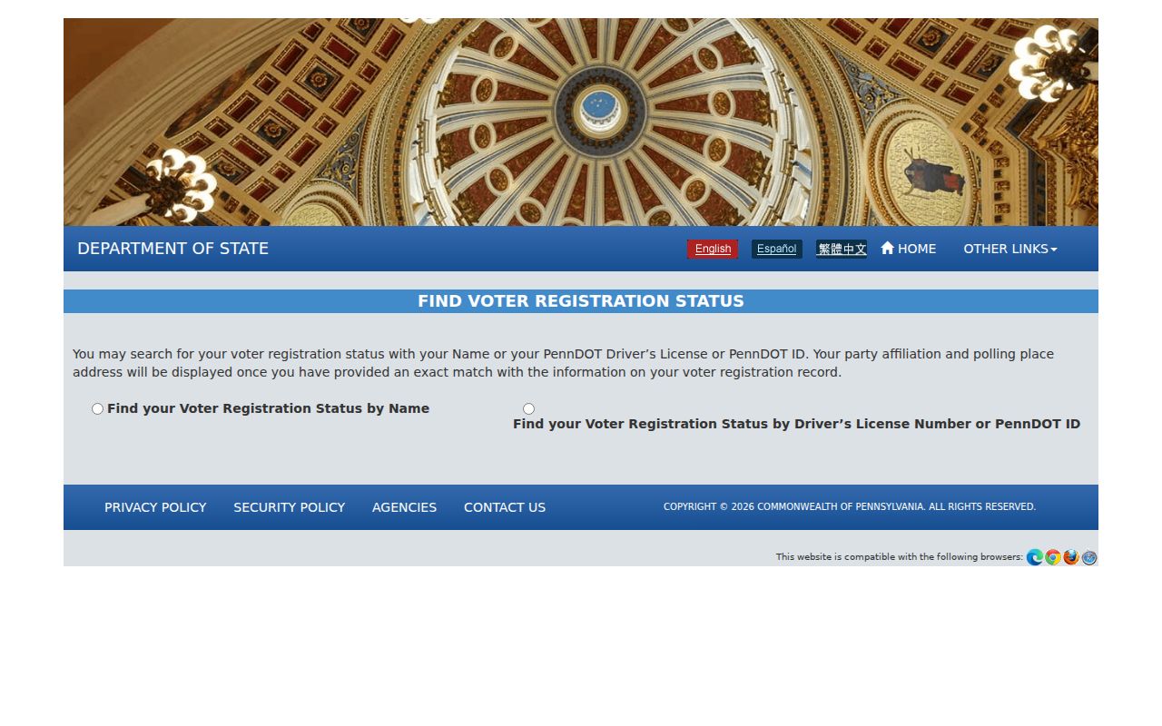
Pennsylvania’s official voter-registration status service is also a self-status tool, not a street or postal browse. Formal public, street, walking, and full voter-list formats use a state request process with requester identification and an affirmation. The state form restricts use and says requested data may not be published online. Use it only for the limited official purpose allowed by the current form.
The official voter-status screen is shown in the Pennsylvania Voter Services source below. Its value here is the boundary: it confirms an individual’s official status through the state service and does not create a Penn Township ZIP search.
For a defined voter-list request, use the state’s current form and follow its distribution, certification, and nonpublication rules. Do not combine a returned list with parcel, phone, or other records.
The Pennsylvania State Police ZIP search warning screen is another narrow example of a ZIP-based official function. It is for the public-safety purpose defined by that program, not a Penn Township residents directory or a general neighbor search.
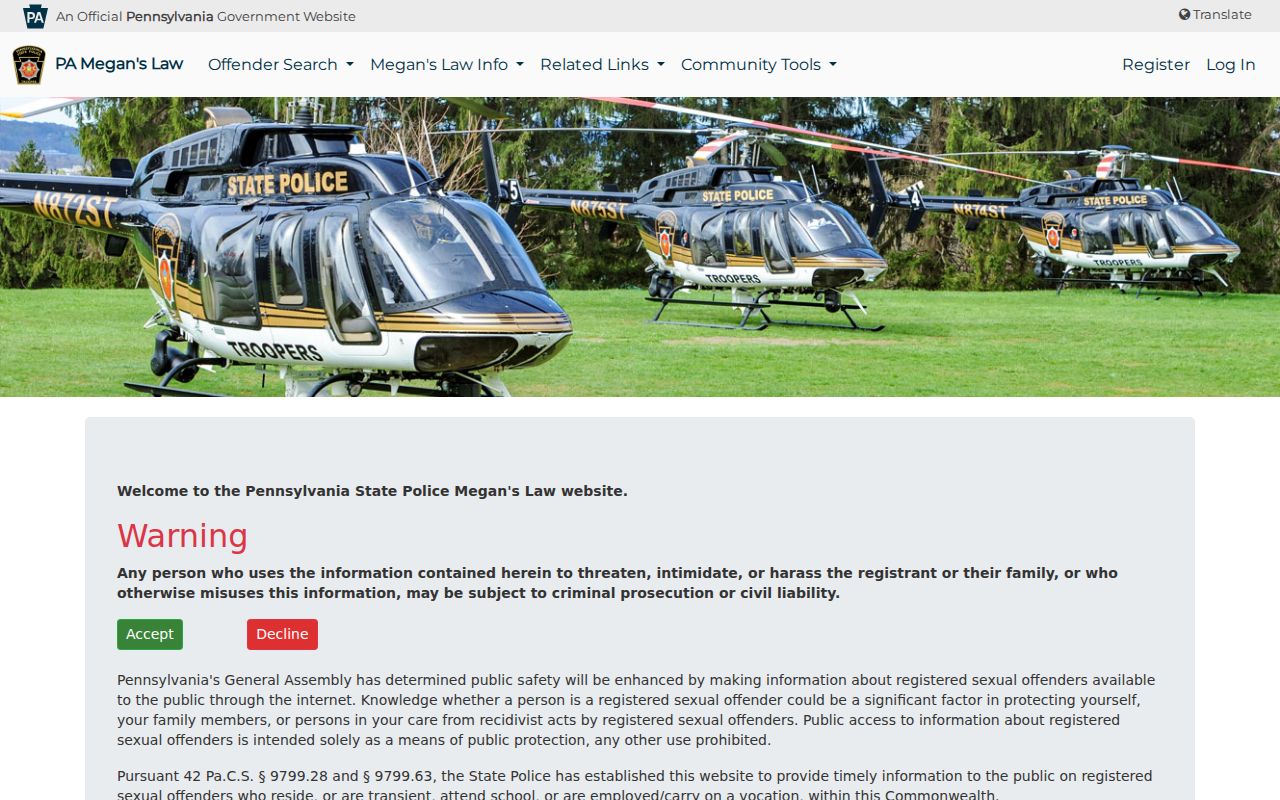
Read that program’s conditions before using its address-radius or ZIP route, and do not republish results, build alerts, or use information to harass or intimidate anyone.
Penn Township Property Search Fields
The County property system supports a narrower, address-first workflow. Its public tax duplicate is updated in late January and late June, so it is not a live title feed. The records can supply a current tax-record clue connected with a parcel, but a tax owner, recorded party, mailing recipient, and current occupant are different facts. Check the date shown with every result.
These are the published field conventions for the County’s property and map tools. None of them is a documented ZIP field. The table is useful because it prevents an address search from being broadened beyond what the portal actually accepts.
| County field | How it works |
|---|---|
| Search By Parcel Number | Use the parcel number exactly as displayed, including embedded or leading digits. |
| Search By Name | Accepts a full or partial owner last name. The County says not to use commas or periods. |
| Search by Location | Use the street core, omitting directional prefix or suffix and the street designator where County instructions say to do so. |
| GIS parcel search | Select a parcel in the public map, then use its information panel and municipal context. |
Once a ZIP has narrowed an address, a full street-level records chain belongs on the Penn Township Street Directory. That records path begins with the parcel, then moves to the Recorder only when a recorded document is needed.
Penn Township ZIP Boundary Checks
Postal zones do not draw municipal, ward, precinct, school, utility, or property boundaries. A 15642, 15085, or 15644 mailing label can appear in local public-resource addresses without establishing that the address is in Irwin, Trafford, or Jeannette as a municipality. The County GIS municipal layer is the proper boundary check for Penn Township.
Parcel identifiers make the location check repeatable. They connect the map, assessment search, and deed research. They are land-record keys, not household identifiers. Where the GIS points to a neighboring municipality, use that municipality and the relevant County office for the next records question, even if the postal label names a Penn Township locality.
- ZIP and ZIP+4
- A ZIP routes mail to a postal area. ZIP+4 adds a smaller delivery segment; neither proves municipal location or residence.
- PO-box ZIP
- A ZIP used for post-office boxes identifies delivery service, not a street parcel or municipal boundary.
- Unique ZIP
- A ZIP assigned to one organization or delivery arrangement is still a postal designation, not a jurisdictional line.
- Carrier route
- A mail-delivery grouping used by the Postal Service. It is not a neighborhood boundary or a public roster.
Penn Township ZIP Wards Differ
Wards and precincts have an election-administration role that differs from a postal designation. Penn Township’s official ward document identifies five wards and eleven precincts, with roads, census blocks, and nearby municipal borders. It is useful for checking civic geography after the parcel location is known. It is not a substitute for the map’s boundary layer, and it does not establish a resident connection to an address.
For an individual election question, contact the Penn Township polling information route or the Westmoreland County Election Bureau. Verify polling arrangements close to an election because locations can change. For an address question, retain the separate USPS and GIS checks rather than treating a precinct label as a postal result.
Note: Ward and precinct labels supply civic context, while the address, parcel, postal label, and municipality each answer different record questions.
Penn Township ZIP Nine-Zone Gap
The official nine-zone statement is valuable because it warns against a single-label view of Penn Township. It also has a limit: the researched Township material names neither all nine zones nor their exact boundaries. That gap is better disclosed than silently filled. A current USPS result can validate a delivery address, while GIS can establish whether the parcel falls in the Township.
Historical work needs the same care. Harrison City, Level Green, Claridge, Paintertown, and Grandview may appear as locality names in older sources. Record each form with its date. Do not merge an old postal designation with a current parcel map without testing the geography and the time period.
Penn Township ZIP Research Limits
The Penn Township ZIP code directory is a routing and verification reference, not a compilation of personal records. County property data refreshes on its stated schedule, Recorder indexes are catalogues that require inspection of the underlying instrument, and mapped parcel information does not resolve private household details. A missing result can reflect the wrong custodian, an update cycle, a protected record, or an address outside the Township.
When an existing local government record is needed, ask the correct custodian for a defined record type, address or parcel, and date range. The Township and County publish Right-to-Know routes for existing records. Pennsylvania’s Right-to-Know Law generally provides a five-business-day response period, subject to its procedures and permitted extension. Personal information that is sealed, redacted, or protected must remain protected.
Note: Access conditions were checked against the cited sources in August 2026, and live portals, forms, fees, and office arrangements can change.