
Penn Township Neighbors by Parcel
For Penn Township neighbors, “neighbor” should mean an adjacent parcel. Westmoreland County’s map and property tools can establish parcel geometry, a displayed situs address, tax-record context, and municipal location. They do not supply a block roster or prove who currently occupies a location. The Recorder can show a recorded land transaction, while the Township can be asked for a defined existing local record. Each source answers a different, limited question.
Start with a single address or parcel and retain the map date. The County makes GIS layers available without charge, but linked property and ownership cards reached from GIS are subscription access. The public tax duplicate has its own update cycle. Read the access column closely before treating any result as current or complete.
| Source | What it shows about a Penn Township block | Access |
|---|---|---|
| Westmoreland GIS Tax Mapping | Parcel boundaries, road context, municipal layer, and map tools around one location | Public map layers are free; linked cards are subscription access. |
| Westmoreland Real Property Search | Parcel, owner-name, and location-query tax-record context | Public tax duplicate, refreshed late January and late June. |
| Recorder Public Access | Recorded parties, legal-description clues, and instruments tied to a parcel trail | County says deeds are indexed online from 1850; inspect the document itself. |
| Township Community Development | Defined permit, zoning, code, or inspection record if one exists | Contact and Right-to-Know route; no public permit-results index found. |
| Historic map and library collections | Dated road, tract, newspaper, and locality context | Map Maintenance, Historical Society, or Pennsylvania Room procedures apply. |
A tax owner, a mailing recipient, a recorded party, and a current occupant are four separate facts. Keeping them separate is the most important accuracy check when examining nearby parcels.
Penn Township Neighbor GIS
Westmoreland GIS Tax Mapping is the primary tool for a parcel-based neighbor question. Use the municipality setting for Penn Township, then inspect parcel outlines near the starting location. The viewer’s documented controls include parcel search, Layers, Identify, Measure, and Print. Layers supply geographic context, Identify can show parcel information, and a saved map date helps explain what was checked.
Do not turn a point, map label, or nearby tax field into a conclusion about residence, title, or private conduct. The County warns that older index mismatches can leave a parcel without a linked deed. When a document matters, search the Recorder with relevant party-name variations and review the recorded instrument or an official copy.
- Adjacent parcel
- A lot that touches the identified parcel boundary. It is a geographic relationship, not evidence that people know each other.
- Parcel identifier
- The County land-record key that connects map, assessment, and deed research. Preserve it exactly with the source date.
- Situs address
- The displayed physical-location address. It can differ from a mailing address and should be checked against the municipal layer.
- Legal description
- The land-description language in a recorded instrument. It can help test a parcel trail but does not replace a survey or title opinion.
Note: The public GIS map supplies place and boundary context, while paid linked cards and recorded instruments follow their own access rules.
Map Penn Township Neighbor Records
The safest Penn Township block method is a short parcel workflow. It begins with one known address and stops at the immediate boundaries shown by the public map. For a longer, named-street record trail, use the Penn Township Street Directory rather than extending a block check into a broad people search.
- Search the address in the Westmoreland Real Property Search. For a location query, follow the County convention that omits directionals and street designators where instructed.
- Open the matching parcel in County GIS, record the parcel identifier and displayed situs address, and verify the Penn Township municipal layer.
- Use Identify and the parcel outlines to note only the lots that touch the starting parcel. Save the map date and avoid inferring a shared household or affiliation.
- When a land-record question remains, search the Recorder Public Access index, then inspect the actual instrument, grantor, grantee, date, and legal-description clues.
Address to parcel, parcel to map, and map to a dated recorded document is a defensible sequence. A Recorder index is like a card catalog, so a search hit alone is not the complete evidence.
Penn Township Neighbor Postal Checks
Shared roads and postal labels create a local boundary trap. Penn Township’s official geography includes Harrison City, Level Green, Claridge, Paintertown, and Grandview, but public addresses use Harrison City, Irwin, Trafford, Jeannette, and Claridge. A Grandview public resource can carry a Jeannette label, while Level Green can carry a Trafford label. Those labels aid mail and orientation, not municipal proof.
Use USPS address validation for delivery formatting and County GIS for municipal context. The Township history says nine ZIP zones serve Penn Township, but the researched official source does not identify every zone or draw their limits. It is better to disclose that gap than make up a neighborhood boundary from a ZIP.
Penn Township Neighbor Resources
No authoritative Township directory was found for neighborhood associations, homeowner groups, block captains, congregations, civic clubs, or volunteer memberships. The five volunteer fire companies are documented public community resources, not membership lists or service-area maps. Their addresses provide a useful local-resource layer without assigning anyone to a group or response area.
Use these contacts for public community and safety information. Confirm current contact details directly with the Township before visiting or relying on a listed location. Local library, historical-society, and research-room collections have separate access and appointment procedures for historical questions.
| Documented public resource | Public contact or postal anchor |
|---|---|
| Claridge VFD | 2307 Baloh Street, Claridge 15623 |
| Grandview VFD | 1655 Ridge Road, Jeannette 15644 |
| Harrison City VFD | P.O. Box 419, Harrison City 15636 |
| Level Green VFD | 536 Route 130, Trafford 15085 |
| Paintertown VFD | 1010 Tray Road, Irwin 15642 |
The Township fire-departments listing is the appropriate source for current public-resource information. It does not support an address-to-membership or address-to-service-area conclusion.
Penn Township Neighbor Voter Limits
Pennsylvania treats voter data as a regulated election record. The official registration-status service is for an individual’s own status, not a browse-by-street or neighbor tool. Formal list requests use state-defined public, street, walking, and full-list formats with a requestor identity and statutory affirmation. The current form also limits permitted use and internet publication.
The state status screen shown in the official source illustrates that individual service. It is not a Penn Township neighborhood record or a basis for compiling data about a block.
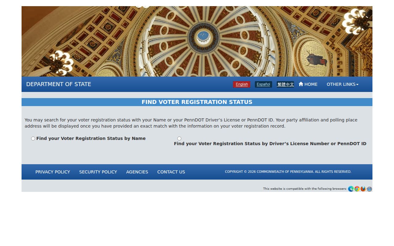
Use the Westmoreland County Election Bureau or the state form for a defined, permitted election-administration request. Never display, index, cache, or combine a voter export with nearby parcel information. An address withheld through the Pennsylvania Address Confidentiality Program must not be reconstructed from other sources.
Penn Township Neighbor Source Comparison
Official sources make their scope and custodian visible. Commercial neighbor tools may combine data from many sources, but they can be stale, incomplete, expensive, or unclear about their original record. Neither category removes the need to check the map date, assessment update, Recorder document, or an agency’s actual access limit.
| Source category | Useful role | Limit to keep in view |
|---|---|---|
| Official GIS and property records | Parcel geometry, municipal context, and dated tax-record fields | Not proof of current residence, title, or a block relationship. |
| Recorder and court custodians | Underlying recorded or docket material under their own procedures | Indexes may be partial, protected records may be unavailable, and a hit needs review. |
| Commercial neighbor tools | May suggest a question to verify with an official custodian | Do not treat compiled profiles as authoritative or republish personal data. |
For a public record that is not indexed, request an existing document from the responsible office by record type, address or parcel, and date range. Pennsylvania’s Right-to-Know Law routes apply to qualifying existing records, not a demand for an agency to identify people or create a new report.
Penn Township Neighbor History
Historical block work needs dated sources. Penn Township was incorporated on February 23, 1855 from parts of Hempfield, North Huntingdon, and Franklin Townships. Earlier land, estate, road, or locality material can therefore be cataloged under a predecessor name. The County’s online deed index reaches from 1850, but older historical context may instead be in County maps, estate material, or library collections.
Compare a dated directory or telephone volume with a map from the same period, then test related tracts in recorded deeds, plans, easements, or estate transfers. The Township’s current Ward Map cannot be projected backward. A historic postal label, a 1913 directory entry, and a current GIS map should remain separate dated observations until a source connects them.
Note: Pre-1855 research may be filed under Hempfield, North Huntingdon, or Franklin Township rather than under the current Penn Township name.
Privacy Limits for Penn Township Neighbors
Penn Township neighbors research must stop where records are sealed, redacted, or protected. Pennsylvania’s Address Confidentiality Program allows eligible participants to use a substitute address for specified government records, including voter registration. Juvenile, expunged, sealed, and other limited-access court material may be unavailable. Motor-vehicle data, financial identifiers, medical information, full birth dates, private contact details, and minors’ information should not be obtained, displayed, or reconstructed.
For an existing Township record, contact the appropriate department with a defined record type, parcel or address, and date range. The Township’s Community Development route handles defined permit, zoning, code, and inspection questions, while the Township Right-to-Know route handles qualifying existing municipal records. Do not ask an office to identify occupants or create a block report.
Note: County, Township, and state systems are separately administered, so current access, forms, fees, and office procedures should be confirmed at the linked custodian.